Pop-Up Optimizer
Rank civic-service stops on a Dallas map using need-weighted clustering.
- Role
- Solo, AI-assisted prototype session
- Stack
Problem
Pop-up health vans, food banks and vaccine clinics need locations that balance population, need and travel distance. A transparent placement heuristic makes those tradeoffs inspectable.
What I built
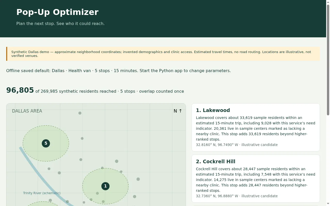
An AI-assisted offline web app offers three services, one to ten stops and adjustable travel windows. Weighted k-means proposes centers, snaps them to sample locations and ranks them by incremental need-weighted coverage.
An SVG geographic map and plain-English explanations show coverage and high-need counts. Shared residents are counted only once in the overall served total.
Results
- The default five-stop health demo covers 96,805 of 269,985 synthetic residents. Population, need indicators and clinic flags are invented demo data, not Dallas demographic estimates.
- All 1,230 Python/JavaScript parity cases pass across services, stop counts and travel windows. Chromium checks cover fully offline browser controls, map links and a 390px mobile viewport. The GitHub Pages version computes locally in the browser and needs no Python server. Data remain synthetic; travel times are approximate and venues unverified.